
GENERAL AND GEOGRAPHICAL DATA:
Surface: 56.542 km2
Surface of the territorial sea: 31.067 km2
Population: 4.381.352 inhabitants
Capital: Zagreb, 770.058 inhabitants
Coastline: 5.835 km, 4.058 km being the coastline of islands, cliffs and reefs
Number of islands, cliffs and reefs: 1.185; the largest islands are Krk and Cres; there are 67 inhabited islands
Highest peak: Dinara 1.831 m above the sea-level
Climate:
* in the interior: moderate continental climate with hot and dry summers and cold and humid winters
* mountainous regions: fresh summer and sharp winters with a large amount of snow
* coastal regions: Mediterranean climate with hot and very dry summers, and mild but humid winters
* average temperature in January:
the interior -1 to 3° C; mountains -5 to 0° C; coast 5 to 10°C
* average temperature in August:
the interior 22 to 26° C; mountains 15 to 20°C; coast 26 to 30°C
Composition of population: the majority of the population are Croats; national minorities are Serbs, Slovenes, Hungarians, Bosniaks, Italians, Czechs and others
Religions: the majority of the population are Roman Catholics, and in addition there are a number of those of Orthodox faith, as well as Muslims and Christians of other denominations
Official language and alphabet: Croatian language and Latin alphabet
BASIC HISTORICAL DATA:
around 400 BC - the first Greek colonies are founded on Adriatic islands
around 100 BC - Romans rule over the east coast of the Adriatic
305. - Roman emperor Diokletian starts to live in his palace in present-day Split
around 600. - Croats start moving to what is today's Croatia
852. - Duke Trpimir issues the charter in which the name Croatia is mentioned in official documents for the first time
925. - Tomislav, the first Croatian king, is mentioned, unifier of Pannonian and Dalmatian Croatia
1102. - after the death of Petar Svacic, the last Croatian king, Croatia enters into a union with Hungary
1527. - because of the danger of the breakthrough of Turks, by the decision of the Croatian Parliament, the Habsburg dynasty ascends to the Croatian throne
1699. - Croatia is largely liberated of Turkish rule
1815. - after the short-term rule of the French, almost all of today's Croatia is included within the Habsburg monarchy
1847. - Croatian becomes the official language of Croatia
1848. - Ban (Vice-Roy) Josip Jelacic defends Croatia against attempts of Hungarian occupation and unites all Croatian provinces ban Josip Jelacic
1918. - after the downfall of the Austro-Hungarian Monarchy in World War I, Croatia becomes a part of the Kingdom of Serbs, Croats and Slovenians, later proclaimed Yugoslavia
1941. - German and Italian forces occupy Yugoslavia; the Partisan resistance, which was put up by Croatian antifascists within Yugoslavia, started to be organized
1945. - the Federative Socialist Republic of Yugoslavia is proclaimed, and within this, today's Croatia is a federative republic
1990. - the first multi-party elections after World War II are organized in Croatia
1991. - Croatian declared independence; after which the Serbian rebellion supported by the Yugoslavian People's Army started from Belgrade
1992. - the Republic of Croatia becomes a member of the United Nations
1995. - the Croatian army quenched the separatist rebellion
2001. - Croatia signed the Stabilization and Association Agreement with the European Union
CULTURAL AND HISTORICAL INHERITANCE:
Croatia abounds with cultural-historical monuments from all periods, thanks to stormy historical events and the intertwining of influences of different cultures. Influences of the Mediterranean culture, numerous monuments from Antiquity, the Roman period and early Middle Ages, Romanesque sacral heritage, and a series of preserved Mediterranean urban complexes characterize its seaside. Continental Croatia is part of the middle European cultural circle and its prominent because of numerous prehistoric finds of world importance, old towns, fortress and castles of the Middle Ages and cultural monuments and architecture of the baroque period.
BELEC - the church of St. Mary of the Snow, from 17th and 18th centuries, with valuable baroque artifacts
DUBROVNIK - one of the best-preserved medieval fortified cities on the Mediterranean; built mainly from the 13th to the 16th century; completely preserved city walls with towers, Rector's palace, the Cathedral, Sponza Palace, the Franciscan Monastery and Lovrijenac fortress; the old town is the part of UNESCO's World Heritage List
DJAKOVO - monumental cathedral of the bishop J. J. Strossmayer from the 19th century
HLEBINE - village near Koprivnica, a cradle of Croatian naive art
HVAR - preserved historical complex from the 15th century, encircled by walls; Hvar Theater from 1612. is the oldest city theatre in Europe
KNIN - medieval fortress above the city; surroundings are the richest architectural finds of the early Middle Ages in Croatia
KRAPINA - paleontological site, Husnjakovo, one of the most significant finds of Neanderthal Man in the world
LEPOGLAVA - the spacious Paulist monastery complex with the Church of St Mary, where the first college in Croatia was founded
MARIJA BISTRICA - the main Croatian pilgrimage center with the votive Church of St Mary
MOTOVUN - picturesque medieval town-museum on top of the hill
NIN - old Croatian churches of St Kriz and St Nikola from the 11th century
OSIJEK - historical urban center, Tvrdja, with a series of valuable buildings from the 18th and 19th centuries
OSOR on island of Cres- historical little town where there are many buildings from the classic and medieval period and well preserved medieval walls
OTAVICE near Drnis, town in the region of Dalmatinska zagora (Dalmatian Hinterland) - mausoleum of the Mestrovic family
PAG - well-preserved urban complex of a planned city, built in the15th century
POREC - historical urban complex; Euphrasius' Basilica from the 6th century, one of the most important early Byzantium monuments on the Mediterranean, inscribed into the UNESCO World Heritage List
PULA - Roman amphitheatre from the 1st century, the third largest in the world; the Roman Golden Gate
RIJEKA - a castle on Trsat and the sanctuary of St Mary of Loretta
ROVINJ - historical urban complex with the Cathedral of St Euphemia from the18th century
SOLIN - archeological area with remains of the large roman town of Salona and a number of early Christian monuments
SPLIT - historical city center with the Antique Diokletian's Palace, one of the most important preserved late Roman historical monuments and a part of UNESCO's World Heritage List; the Cathedral of Saint Dujmo, the old Croatian church of St Trinity and other significant locations
SIBENIK - historical urban complex with the famed Renaissance Cathedral of St Jacob, the work of famous sculptors Juraj Dalmatinac and Nikola Fiorentinac, and a number of palaces and churches, a part of UNESCO's World Heritage
TRAKOSCAN - a Romanesque castle above the Trakoscan Lake
TROGIR - historical town on a small island; a Cathedral from the 13th century, with the famous portal of the master Radovan; the town is inscribe into the UNESCO World Heritage List
VARAZDIN - well preserved baroque urban complex; a number of valuable palaces, churches and monasteries; monumental Old town; city cemetery from the 19th century with its unique horticulture
VELIKI TABOR in Hrvatsko zagorje - the best preserved Renaissance fortress in Croatia from the 16th century
VUKOVAR - prehistoric archeological find, Vucedol, one of the most significant Neolithic finds in Europe; Eltz castle was hardly damaged during Serbian aggression on Vukovar in 1991.
ZADAR - historical urban complex with well-preserved walls; several antique and early medieval monuments, including a Roman forum and the unique pre-Romanesque circular church of St Donat from the 9th century
ZAGREB - historical urban complex of the medieval Upper Town and Kaptol; planned Lower Town from the second half of the 19th century, with a series of parks in the shape of horseshoe; the Zagreb Cathedral is the most prominent in the country
THE MOST IMPORTANT MUSEUMS:
DUBROVNIK - Archaeological Museum, Ethnographic Museum, Museum of Contemporary Art, Maritime Museum, Treasury of the Cathedral, Marin Drzic House
CAKOVEC - Medjimurje Country Museum
GOSPIC - Country Museum of Lika, in the nearby Smiljan is the biographical collection of Nikola Tesla in his birthplace
HLEBINE - Gallery of Naive Art, Museum Collection of Ivan Generalic
KARLOVAC - Karlovac Country Museum
KLANJEC - Gallery of the sculptor Antun Augustincic
KRAPINA - Museum of Evolution located next to the site of Neanderthal Man; the birthplace of Ljudevit Gaj
KUMROVEC - The Old Village - the unique Ethno-museum with original village houses including the native house of Josip Broz-Tito
MAKARSKA - Malacological Museum (collection of shells)
OSIJEK - Museum of Slavonia, Gallery of Art
PAZIN - Ethnographical Museum of Istria, Pazin Country Museum
PULA - Archeological Museum of Istria, Historical Museum of Istria
SPLIT - Museum of Old Croatian Archeological Monuments, Archeological Museum of Split, Gallery of the sculptor Ivan Mestrovic
TRAKOSCAN - Castle-Museum Trakoscan where with a huge collection of old weapons
VARAZDIN - Town Museum in the Old Town- Historical Section and Entomological Section (collection of insects)
ZADAR - Archeological Museum, National Museum, Maritime Museum, the Permanent Exhibition of Sacral Art
ZAGREB - Archeological Museum, Ethnographic Museum, Croatian Museum of Naive Art, Modern Gallery, Museum of the City of Zagreb, Mimara Museum, Museum for Arts and Crafts, Natural History Museum, Museum of Contemporary Art, Strossmayer's Gallery of Old Masters, Technical Museum
IMPORTANT CULTURAL EVENTS:
DUBROVNIK - Dubrovnik Summer Festival - theatrical and musical performances (July-August)
DJAKOVO - Djakovo Embroideries - festival of Slavonian folklore (July)
GROZNJAN - in central Istria - Groznjan Music Evenings (July-August)
DJURDJEVAC - Picokijada - folklore festival (June)
KRK - Krk Summer Festival - concerts of classical musicians (July-August)
OSOR - island of Cres, Osor Music Evenings (July-August)
SINJ - Sinjska Alka (Sinj Tilting at the Ring) competitions of chivalry (August)
SPLIT - Split Summer - theatrical and musical performances (July-August)
SIBENIK - International Children's Festival (June-July)
VARAZDIN - Varazdin Baroque Evenings (September-October)
VINKOVCI - Vinkovci Autumn Festival (September)
ZAGREB - Zagreb Summer Festival (July-August), International Festival of Experimental Theatres (June-July), International Folklore Festival (July), Biennial Festival of Contemporary Music (April), International Puppet Festival (August-September), World Festival of Animated Films (June)
CRIKVENICA, DUBROVNIK, LASTOVO, NOVI VINODOLSKI, RIJEKA, SAMOBOR, SENJ - Carnival (January-February; Novi Vinodolski and Senj, also in July and August)
NATIONAL PARKS:
BRIJUNI - a group of two larger and 12 smaller islands along the west coast of Istria; preserved Mediterranean vegetation, zoo in the nature, cultural heritage of Antiquity. Due to its extraordinary beauty, the Brioni Islands have been, for over a hundred years now, a favorite tourist destination of world statesmen.
KORNATI - the most indented archipelago on the Mediterranean with 140 uninhabited islands, islets and cliffs- it looks like a labyrinth of rocks and the sea. The Kornati islands are known for their varied unusual forms and extraordinary relief structure, and especially the high cliffs. It is also a very popular destination among the sailors, there is a marina Piskera in the national park and eight other marinas nearby.
KRKA - the most beautiful karstic river in Croatia, occupies the area between Knin and Skradin; deep canyons are carved in limestone plateaus; among many waterfalls, the most famous are Skradinski Buk and Roski Slap; between these two wonderful waterfalls is located Visovac Lake and the Franciscan monastery, which is located in the point where river enter the lake.
MLJET - an island of the Southwest of Dubrovnik; the west part of the island is a national park characterized by two deep bays which are called lakes due to their very narrow passages to the open sea; lush and diversified Mediterranean vegetation, valuable monuments from classical period and Benedictine monastery from the 12th century on islet in the midst of the lake.
PAKLENICA - a national park on the southern side of Velebit, the largest mountain massif of Croatia. Two impressive canyons of Velika and Mala Paklenica, vertically cut into the mountain from the sea to the peaks are the main attraction of the park; there are several unusual carstic forms, several caves, and extremely rich and varied flora and fauna; monumental steep rock Anica kuk is the most popular destination for Croatian alpinists training
THE PLITVICE LAKES (PLITVICKA JEZERA) - the most beautiful and the most popular Croatian national park, part of the UNESCO's World Heritage, situated at the main road from Zagreb to Dalmatia; 16 little lakes interconnected with waterfalls created by deposition of travertine, dense forests of beech and fir, partly in the form of primeval virgin forest, many animal species (including the brown bear); there is a special vehicle for transporting visitors (panoramic trains and electric boats).
RISNJAK - a wooded mountain massif to the north of Rijeka; due to its position at the junction between the Alps and the Dinarides, almost all types of forests, as well as many plant and animal species are gathered here, in a relatively small area, including brown bear, lynxes, leaps, dears, eagles; the beauty of the forest, carst phenomena, beautiful springs and magnificent views attract many hikers.
NORTH VELEBIT (SJEVERNI VELEBIT)- due to its natural beauty is the most valuable and the most attractive peak part of Velebit. It includes nature reserves Hajducki and Rozanski kukovi with attractive Karst forms and Luka's cave, one of the deepest in the world and the famous Velebit Botanical garden.
PARKS OF NATURE:
Nature parks are wide natural or cultivated areas with high esthetical, ecological, educational, cultural-historical and tourist-recreation values.
BIOKOVO - a grandiose mountain above Makarska Riviera; various flora and fauna, beautiful sights
KOPACKI RIT - an extensive wetland area located at the confluence of the Rivers Drava and Danube; rich in plants and animals, particularly wading birds, deer and wild boars
LONJSKO POLJE - one of the largest swamps of Europe, located by the river of Sava, east from Sisak; huge oak forests, rich bird fauna, particularly storks
MEDVEDNICA - a mountain massif above Zagreb; recreational area where there are beech and fir-tree forest, attractive caves and deep stream valleys
TELASCICA - a spacious narrow bay on the island of Dugi otok, near the National Park Kornati; a navigators' destination; a small lake next to the sea and the biggest croatian cliffs (up to 800 m)
VELEBIT - the biggest and the most beautiful Croatian mountain; due to its unique relief and its plants and animals, it's declared the World reserve of Biosphere; the greatest protected area in the country, it includes both National parks North Velebit and Paklenica
ZUMBERAK-SAMOBOR MOUNTAINS - north of Zagreb; spacious meadows, picturesque villages with well-indented relief and deep canyons
PAPUK - the largest mountains in Slavonia; significant due to its forest cover and partly eruptive relief
UCKA - a mountain on the east of Istria, above the Kvarner Riviera; interesting relief and flora, magnificent sights
LAKE OF VRANA - the largest lake of Croatia, near Zadar; due to its vicinity to the sea, there are both sea and freshwater fish in it and itis also famous for variety of birds
OTHER PROTECTED AREAS:
* two strict reserve
* 73 special reserve (botanical, geomorphologic, hydrological, ichthyologic, ornithological, maritime, zoological), 27 park-forests, 28 significant landscapes, 75 natural phenomenon (geological, geomorphologic, hydrological, paleontological, rare trees examples) and 120 horticultural locations (arboretum, botanic gardens, parks, trees and groves)
* a total surface of protected areas is 4.585 km, or 8 per cent of the Croatian surface; 380 animal species and 44 plants are protected
Other natural sights to visit:
RIVER DRAVA - one of the largest rivers of Europe a significant part of which is in its natural condition; proposed as a World Biosphere Reserve
RIVER DOBRA - at Karlovac; known because of its cleanliness, richness of fishes and attractive canyons and rapids; it's a perfect place to go rafting, kayaking or canoeing
RIVER MREZNICA - at Karlovac, with a series of waterfalls on gypsum barriers; attractive canyons and favorite bathing sports
WHITE ROCKS (BIJELE STIJENE) AND SAMARSKE ROCKS (SAMARSKE STIJENE) - on Bjelolasica mountain in region of Gorski Kotar; a multitude of bizarre karstic forms in the wild and wooded landscape; strictly protected nature reserve
DEVIL'S PASSAGE (VRAZJI PROLAZ) - at Skrad, a small town in the central part of Gorski Kotar; a picturesque narrow canyon with a scary footpath in the rock passing through it; at the entrance of the canyon is the attractive waterfall Zeleni vir
LIM GULF (LIMSKI ZALJEV) - the picturesque deep sea bay at the west coast of Istria; it's very narrow and sharp, so it looks like a Norwegian Fjord
RIVER GACKA - in Otocac, town in region of Lika; with series of picturesque springs and old water mills, known as one of the most significant fishing sports for trout in Europe
GOLDEN CAPE (ZLATNI RAT) at BOL, a town on island of BRAC - it's probably the most beautiful beach on Adriatic; it's a pebble cape, surrounded with pine forest; the cape changes the form according to the direction of waves
BLUE LAKE and RED LAKE - lakes at Imotski, town in region of Dalmatinska zagora (Dalmatian Hinterland); the unique deep karstic phenomenon of two exceptionally deep holes (Red lake is 500 m deep)
BLUE CAVE - a famous cave on island of Bisevo, near the island of Vis; prominent because of its blue color; according to many, much nicer than the similar but better known cave on Capri
DELTA OF NERETVA - in the south of the country, the unique swampy area with specific vegetation of reed, famous for its gathering of a large variety of birds
SPORTS, RECREATION, FUN:
Sports grounds: next to most hotels and campgrounds on the Adriatic are numerous grounds for tennis, basketball, beach volleyball and other sports. Tennis is especially popular, and Umag in Istria and Zagreb host the ATP tournament and Bol on Brac hosts the WTA tournament.
Water sports: in bigger tourist centers, it's possible to rent boats, fishing and diving equipment, and there are numerous scuba diving schools and schools for wind-surfing. Rafting is organized on rivers Cetina and Dobra. You can experience a wild kayak or canoe riding on rivers Kupa, Korana, Mreznica, Cetina and Una.
Climbing: marked mountain trails, mountains hut and shelters are on all larger mountains, and especially in Gorski Kotar, Velebit, Ucka, Mosor, Biokovo, Medvednica, Zumberak, Ivancica and Papuk.
Stadiums: for Olympic sports and large sports hall are found in Split and Zagreb, where Students World Championship (Universiade) and Mediterranean Games were held. Large stadiums and sports halls are also found in other major towns.
Entertainment: most highly rated hotels have casinos and nightclubs, especially in Zagreb, Opatija, Umag, Porec, Rovinj, Pula and Dubrovnik.
All larger cities and major tourist resorts on the Adriatic have disco clubs, while in summer, dancing evenings under the open sky and various entertainment events are regularly organized
FEED Carnivals in Croatia
ABOUT CROATIA
![]()
Visit Croatia - When?
The time period from April to October is consideredthe best time to visit Croatia.
Summer temperatures can reach up to 38°C, whilesurface water temperatures go up to a pleasant 26°C. July and August areconsidered the most frequently visited period due to various entertainmentfacilities and events for young people, while for those looking for differentand more peaceful ways of spending their holiday Croatia also has a lot tooffer. Spring is characterized by pleasant and mild weather accompanied by rare,short showers, while early autumn is ideal for those looking for a tranquilholiday. Out of high season, the beaches are not crowded with bathers andaccommodation prices are significantly lower, while the weather remains stable.
We recommend traveling along the Croatian coast throughout the entire year.Winter is characterized by somewhat colder weather. Due to the Mediterraneanclimate, winds are known to be quite strong and unpleasant, although temperaturesrarely drop below zero.
Materials used: Generalturist
![]()
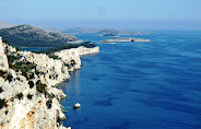
Islands of Croatia
The Croatian coast and islands lie in an area with the Adriatic type of Mediterranean climate. Summers are hot and dry, winters are mild and moist, and insolation is significant. Special climate characteristics differ, though, from one island to the next, depending on position, altitude or exposure to winds. The main factor influencing the island climate and flora is the Adriatic , which is considered a warm sea. Surface sea temperatures usually do not drop below 10C in winter and do not exceed 25C in summer. Apart from larger ports, the waters surrounding the islands are clean, as is the entire part of the Adriatic belonging to Croatia .
The Croatian islands encompass almost all of the islands on the eastern Adriatic coast and its middle area, forming the second largest archipelago in the Mediterranean . There are 1185 of them, geographically divided into 718 islands, 389 cliffs and 78 reefs.
The accommodation offer on Croatian islands is diverse you can choose among hotel accommodation, private accommodation in apartments or holiday houses, while accommodation in rural households (rural tourism) is especially attractive.
You can book accommodation in old authentic stone houses, as well as in lighthouses.
In recent years, summer holidays in lighthouses are, thanks to their originality and the specific experience and ambience, an absolute hit within Croatia s tourist offer. Sometimes in the tourism industry, this kind of holiday is also categorized as "Robinson Crusoe Tourism". Due to high interest, we recommend early booking of the desired time period.
Croatia s islands can be reached by regular and additional ferry lines from Split , Rijeka (June September) or as part of interesting cruise itineraries on the Croatian Adriatic.
A hundred years ago, some 20 000 people lived on these islands; the decline in the number inhabitants is still continuing. Although the islands take up some 3 300 km2, that is 5,8% of the Croatian mainland, they define the territorial sea, which makes up almost 37% of the entire Croatian territory (without the islands the territorial sea would be two-thirds smaller). The largest island is Krk (410 km2), 77 of them are over 1 km2, and only 20 of them are over 20 km2. Being well indented, the coast of Croatia s islands is longer than that of the mainland. Croatia 's entire seacoast amounts to 5 835 km, with the coasts of islands making up 4 057 km (69,5%). All inhabited islands in the eastern and central parts of the Adriatic belong to Croatia . There are fifty of them and they take up an area of 3 000 km2. Some 15 islands, which are inhabited temporarily (during the season), could also be added to this total.
Materials used: Generalturist and www.hr
![]()
Beaches in Croatia
Croatia has 1777 km of indented coastline, including 1185 islands, islets andcliffs, of which 47 are inhabited.
The coastline and beaches are mostly coveredin rocks, sand and pebbles with numerous inlets and capes. The vegetation is mostly coniferous (pine, larch, cypress...), whereas, in some areas of Istria and Kvarner,shade will, besides conifers, also be provided by Sessille oaks. High and lowtide have relatively small amplitudes of about 0,5 m. Besides the crystal clear and clean sea, the main characteristic of Croatia’scoast are its diverse beaches, where everybody can find something to suit theirtaste: shallow sandy or pebble beaches for families with children, romantic andsecluded bays or cliffs, well known and famous beaches with entertainment facilities,nightlife and sports offer, windy bays and channels for windsurfers, quiet baysand cliffs for diving enthusiasts...
The majority of beaches in Croatia are rockyor pebble beaches, while you can also find a small number of sandy beaches.
Beaches you must visit
Berulija Beach and Punta Rata - Brela, Zlatni Rat - Bol (island of Brac), Banje Beach and Lokrum - Dubrovnik, Vela Plaza Beach - Baska (island of Krk), Rajska plaza Beach - Lopar (island of Rab), Crveni Otok - Rovinj, Zrce Beach - Novalja(island of Pag), Suncana uvala - Mali Losinj (island of Losinj), Milna and Dubovica - island of Hvar, Pinija Beach - Petrcane, Raduca Beach - Primosten, Makarska, Zelena Punta, Kukljica - island of Ugljan, Drazica Beach - Biogradna moru...
Sandy beaches in Croatia
Trincel - island of Pag, Lumbarda - island of Korcula, Lopar - island of Rab, Sabusa, Jelenica and Kostanj - island of Ugljan, Lapad - Dubrovnik, Trstenica - Orebić, Slanica - Murter, Bayof Saplunara - island of Mljet...
Beaches for entertainment and fun
Zrce Beach - Novalja (island of Pag), Porec, Pudarica - Barbat (island of Rab), Banje - Dubrovnik, Saharun Beach - Dugi otok, Zlatni rat - Bol (island of Brac), Vodice, Bacvice Beach - Split, Slanica - Murter, Jelsa - island of Hvar, Girandella Beach - Rabac...
Beachesfor families with children
Bay of Klimno - island of Krk, Brela, Crikvenica, Jelsa, Medena - Trogir, Zaton - Zadar, Korcula - island of Korcula, Vela Plaza Beach - Baska, Makarska, Rajska plaza Beach - Lopar, Rovinj, Dugi Rat - Omis...
The best windsurfing destinations
Zlatni Rat - Bol (island of Brac), Punat - island of Krk, Viganj, Orebic - Peljesac, Premantura - Medulin, Girandella/Ravni - Rabac, Jadrija - Vodice,Savudrija - Umag, Bayof Preluk - Opatija...
The best diving destinations
Island of Cres, island of Losin, Lucica Cave - island of Brac, Pakleni islands - Hvar, Elaphiti islands - Dubrovnik, island of Rab, Rovinj, Porec,...
Materials used: Generalturist
![]()
Roads in Croatia
Main Roads in Croatia
A1 (E65/E61): Zagreb - Split (Karlovac-Gospic-Zadar-Sibenik) 380km
A2 (E59): Zagreb - Macelj (Krapina) 60 km
A4 (E71): Zagreb - Gorican (Varazdin-Cakovec) 97 km
A6 (E65): Zagreb - Rijeka (Karlovac) 144 km
A3 (E70): Bregana - Zagreb - Lipovac (Kutina-Nova Gradiska-Slavonski Brod- Zupanja) 270 km
A8 and A9 (E751, Istarski ipsilon): Umag-Kanfanar-Vodnjan 65 km; Rijeka- Kanfanar-Vodnjan 81 km
D1 (E71): Karlovac - Split (Plitvice Lakes National Park-Gracac-Knin-Sinj)
D8 (E65, Jadranska magistrala): Rijeka - Dubrovnik (Senj-Zadar-Sibenik- Split-Makarska-Ploce)
Toll
The toll is charged according to the length of motorway traveled and vehicle category. It can be paid in cash, by credit cards AMERICAN EXPRESS, DINERS, MASTER CARD, MAESTRO and VISA, by checks and by prepaid cards, as well as in foreign currencies according to the exchange rates of PBZ Bank on the day of payment.
Zagreb - Split: 157 HRK
Zagreb - Macelj (Krapina): 10 HRK
Zagreb - Gorican (Varazdin): 45 HRK
Zagreb - Rijeka: 56 HRK
Bregana - Zagreb: 5 HRK
Zagreb - Lipovac: 92 HRK
Ucka Tunnel (Rijeka - Pazin): 28 HRK
Krcki most Bridge: mainland - island of Krk: 30 HRK
Speed Limits
From the Law on Safety of Road Traffic:
- The speed limit in built-up areas is 50 km/h, that is, the limit defined by traffic signs set for the entire built-up area or its part(s).
- The speed limit outside built-up areas is defined by traffic signs, and amounts to a maximum of
1) 130 km/h on motorways
2) 110 km/h on roads intended solely for motor vehicle traffic and on fast roads
3) 90 km/h on other roads
Information on Road Conditions and Roadside Assistance
Road conditions and passability of roads:
- HAK - Croatian Automobile Club: +385 (0)1 4640 800
- Croatian Radio - II channel, 98,5 MHz,every hour from 6:30 till 20:30 (during the tourist season in English, German and Italian)
Roadside Assistance: Tel: 987
Petrol Prices in Croatia*
Lead free fuel - SUPER 95 ~1.06 €
Lead free fuel - EUROSUPER 95 ~ 1.08 €
Lead free fuel - SUPER PLUS 98 ~ 1.10 €
Diesel fuel - DIZEL~ 0.98 €
Diesel fuel - EURODIZEL~ 1.00 €
* variable and depend on oil prices on the world market
Important Road Border Crossings in Croatia
-from the direction of Venice - Trieste - Izola: Rupa - Jelsane, Plovanija - Secovje, Kastel - Dragonja, Pasjak - Starod
-from the direction of Munich - Salzburg - Ljubljana: Bregana - Obrezje, Rupa - Jelsane, Pasjak - Starod
-from the direction of Prague - Vienna - Graz: Macelj - Gruskovlje, Lupinjak - Dobovec, Dubrava Krizovljanska - Zavrc
-from the direction of Bratislava - Budapest: Gorican - Letenye, Mursko Sredisce - Petisovci
-other directions from Hungary: Terezino Polje - Barcs, Beli Manastir - Magjarbolye, Donji Miholjac - Dravaszabolsz, Koprivnica - Gyekenyes, Gola - Berzence
-from the direction of (Sofia), (Athens) - Belgrade: Bajakovo - Batrovci
-from Bosnia and Herzegovina: Zupanja - Orasje, Slavonski Samac - Bosanski Samac, Slavonski Brod - Bosanski Brod, Stara Gradiska - Bosanska Gradiska, Licko Petrovo Selo - Izacic, Maljevac - Velika Kladusa, Vinjani Donji - Gorica, Metkovic - Doljani
-from Montenegro: Karasovici - Sutorina
Materials used: Generalturist
![]()
Sailing in Croatia
Croatia is indeed an ideal sailing destination.
With more than 1000 islands, one can truly enjoy swimming in crystal clear sea in the Kornati archipelago or in the hidden bays throughout the Adriatic coast.
You are about to experience unforgettable sailing holiday !
Croatia can offer many interesting sailing routes, we are suggesting the following:
1. South - Lastovo
2. South - Dubrovnik
3. South - Vis
4. North - NP Kornati
Due to mild Mediterranean climate, Dalmatia is a recommended sailing destination from March to November. It is possible to charter a yacht or a sailboat in winter months as well, but due to strong winds and rough seas, sailing is recommended in the warmer months only.
There are approximately 60 marinas on the Adriatic coast, while there are many bays well protected from the winds where one can spend the night throughout the entire coast.
Croatia is the most popular in July and August, it is difficult to get a good selection of sailboats if booking last minute, so we recommend booking a yacht or a sailboat in March or April for the summer months.
Materials used: Generalturist
![]()
Island of Cres
 The island of Cres, by size the first island in the Adriatic, is located in the northern part of the Bay of Kvarner. Its southern part, i.e. the town of Osor, is linked to the island of Lošinj by a trestle bridge. Cres is a hilly island, 66 km long and ranging in width from 2 to 12 km. The island's coastline , 248 km long, is indented; its western and southern part have a plenty of bays and pebbly beaches while the northern and eastern part are characterized with steep and rough rocks. The highest tops of the island - Gorice (648m) and Sis (638) - offer a unique view of the Bay of Kvarner which will not leave anyone indifferent. The fresh water lake of Vrana, which covers the area of 5. 75 square kilometres , deserves attention as an unusual natural phenomenon. The level of the lake is above the level of the surrounding sea, and its bottom is beneath the sea level only at the depth of 74 m. The landscape of Cres owes its attractivity to a sharp contrast between the northern sub mediterranean part covered with high and thick woods of oak medunac (Quercus lanuginosa) , hornbeam, elm, and chestnut trees, and the middle and southern parts which are covered with bare grazing lands and dense macchia. A great richness of the botanical and animal world, which boasts more than 1300 species and an exceptional number of endemic species, is a genuine challenge to all nature lovers. Cres is also one of the last habitats of a rare bird species - griffon vulture. The island of Cres was first inhabited in the New Stone Age. The continuity of life on the island has created an exceptionally rich cultural and historical heritage: from a number of Liburnian ruins, the remains of Antique towns, early Catholic churches scattered around the island, monaste
 ries and remains of towns from the period of the Republic of Venice to the monuments of the contemporary period. The town of Cres is situated in the northeastern part of a large and well shielded bay which abounds in spacious and attractive bathing areas. The human activity, dating back to the Antique period, has left a whole range of monuments which help us to imagine how difficult life must have been on this island. The panorama of present day Cres is marked with the medieval harbour "mandrac", Gothic and Renaissance churches and monasteries, noble families' palaces and the remains of town walls. Until the end of the period of Venetian domination Cres remained confined within the town walls, two monasteries being the only buildings located outside the walls. It was a development of seafaring and shipbuilding in the middle of the 19th century that brought about great changes. The town started spreading to the south and west. At the turn of the 20th century Cres provided catering services for its guests in two hotels "Miramare" and "Excelsior". A more intense development of tourist industry started in the 60s and 70s of the previous century.
The most important cultural and historical monuments in Cres are:
1) Three town gates, Bragadina, Marcela and the gate of St Mikulo from the 16th century;
2) A round, corner tower in the northwestern part of the town;
3) The church of St Isidor from the 12th century;
4) A number of Gothic, late Gothic and Renaissance churches
 the most remarkable of them being the Church of Our Lady of Snow dating from the 16th century with a tower bell from the 18th century;
5) Municipal Loggia with a pillory;
6) A Franciscan monastery from approximately 1300 with the Church of St Francis from the 14th century and a tower bell from the 18th century;
7) A benedictine monastery from the 15th century;
8) The palace of the family Patris from the 15th century which houses a museum;
9) A number of Renaissance palaces of noble families from Cres
![]()
Novi Vinodolski
 Novi Vinodolski is the picturesque tourist center on the northern part of the Adriatic coast on the Riviera of Novi Vinodolski at the entrance of the Vinodol valley. In 1878, thanks to the evergreen vegetation and mild Mediterranean climate, clean sea and air it gained the position, after Opatija, of being tourist pioneer of the seaside region. Novi Vinodolski, along with its hotels and apartments, has many restaurants which serve wonderful seafood and traditional cuisine. The soul of the town is represented by the rests of the cultural heritage: walls of the Roman fortress "Lopsica", rests of the Paulist friars' monastery, Frankopan citadel with stronghold, cathedral, chapel of the Holy Trinity and St. Marin on the homonymous islet, the house of the brothers Mazuranic, reading club and library from 1845, homeland museum and gallery, the old core of the town as well as the preserved authentic folklore of this town. The traditional hospitality of the population, crystal-clear sea, town and surroundings without industrial pollution, circulating of mountain air from high forests in the nearby hinterland grant to Novi Vinodolski inestimable ecologic advantages especially for the development of the tourist and hospitality industry. Sports and recreation constructions, open air and indoor swimming pools with seawater, saunas and other facili
 ties for tourists' personal needs have been built. The sea of the town port with moors for boats, petrol stations, a crane and a ramp for lifting up and floating the boats, parking grounds for cars, trailers and boats are intended for nautical tourists for whom the service of aid and rescue at sea is organized too. In history, Novi Vinodolski affirmed itself as political and cultural centre of the Principality of Vinodol ("Vinodol" - "Vallis vinearia") and with "The Vinodol Code" in 1288. It was the craddle of a pleiad of writers of the family Mazuranic. The medical and pharmaceutical services, TT services and telecommunications, banks, exchange offices, portmaster's office and other personal services satisfy the needs of tourists and the local population.
![]()
Opatija
 Opatija is tourist destination with the longest tradition on the Adriatic coast. Opatija is situated on the Kvarner bay coast, geographically on the east coast of the Istrian peninsula. With a long tourist tradition, it welcomes guests from all over the world. Opatija is first mentioned in the 15th century, and the name comes from the old abbey, San Giacomo della Priluca. The city tourist history begins in 1844 when Villa "Angiolina was built and it welcomed mostly Austrian and Croatian aristocracy. The first hotel named “Kvarner” was built in late 19th century and it w
 as the first hotel on the east coast of the Adriatic. Opatija, as the center of the Opatija riviera, is again the elite destination on the Mediterranean. You can find many luxury hotels like hotel Admiral, hotel Palace Bellevue or Grand Hotel Adriatic as well as other hotels. Today Opatija is the destination of choice for congresses and convention tourism, as well as wellness programs. This, along with its moderate climate, makes Opatija an attractive destination all year long.
![]()
Island of Rab
 Glavina in SE. It biggest width is 11 m. The Velebit canal separates the island from the mainland. The closest gets to the mainland is on its SE end, 2 km. It is separated from the island of pag by the «Pasko tijesno» canal, in the west, towards Cres and Losinj, there is Kvarneric, and «Senjska Vrata» separates it from the island of Krk in the NW. There are lots of smaller islands around Rab: Goli, Grgur, Maman, Lagnj Veli, Laganj Mali, Dolfin Veli, Dolfin Mali, Trstenik, Dolin, Sv. Juraj… Other than the small town of Rab, there are 7 idyllic places on the island situated on different parts of the island: Barbat, Banjol, Palit, Kampor, Mundanije, Supetarska Draga and Lopar. The island of Rab has approximately 10000 inhabitants who are mostly occupied in agriculture, fishing and tourism. The tradition of organised tourism on the island is more than 100 years old and it started through the activities of the «Society for promotion of the island and its Surroundings». Which has founded in 1889. The reasons for the development of the tourism on the island, which are s
 till current, are: attractive climate, the conditions on the island that have satisfying influence on the respiratory and cardiac problems. Such a long tradition of offering service of high quality is not just the result of skills, experience and hospitality of the people that is passed from one on to another, but also the result of the foundation of the catering and tourism school that s highly appreciated now days and of which we are proud. The traditional hospitality and polyglot skills of the inhabitants will make you become a part of their family and after some time you will feel like a «born» islander! Our tradition of organized tourism is more than 110 years old due to the formation of the "Society for improvement of the city and its surroundings" which was founded in 1889.The arguments for the development of tourism on the island were then and they are still today the following ones: pleasant climate, healing influence of the island air on the illnesses of respiratory system and heart diseases. Such along tradition of high quality services, which are offered to You, is not only result of skills, experience and hospitality of Your hosts, which inherited this knowledge from their ancestors and further enriched it, but also of formation of the "Tourist School" which is nowadays highly valued and we are all very proud of it. The island of Rab has a very pleasant Mediterranean Sea climate, with mild winters and pleasant moderate summers. For such climate Rab has to thank to Kamenjak, a mountain chain that protects it from the cold northern wind in winter and early spring. In autu
 mn there is a hot and humid wind from the south normally followed by rain. During the summer the heath is tempered by pleasant breeze. Rab has approximately 91 completely sunny days a year and it is one of the sunniest parts of Europe. During the summer there are only 9 cloudy days. The number f sunny hours are around 2479 a year or 6 hour a day. In July the average is 12 sunny hours a day. The amount of rain is around 1042 mm a year. The sea temperature is relatively high. That helps the development of tourist because it is possible to enjoy it from May till the middle of October. The approximate sea temperature a year is 15,75 ºC. The approximate sea temperature from May till October is over 20ºC, during the winter 12 ºC. During the summer 26 ºC during the winter 8 ºC. What is characteristic and unusually beautiful in the relief of Rab is the rhythm of elevations, isthmuses and fields. The elevation that starts with peninsula Kalifront joins through the shallow and low Kampor field to bigger hills, spreading from northwest to southeast, from Gonar to Kaldana in Rab abd Banjol. It is the rhythm
  of hills and flat stretches that makes the relief of Rab so characteristic and unusually beautiful. The rise that starts on the peninsula of Kalifront is continued, after crossing the valley of Kampor. By somewhat higher hills stretching NW to ES, from Gonar to Kaldanac (town of Rab) and to Banjol. Between these hills and the major range, Kamenjak, which runs parallel to the Velebit range on the mainland, there is a valley, which starts, north, in Supetarska Draga and ends at Banjol. The highest range of the island, Kamenjak (408m), whose slopes drop steeply down to the Velebit Channel, represents a natural barrier that protects the island from the cold northern wind – the bura. The coast of the island is of varying indentedness, the northeastern part, at the foot of Kamenjak range, is hardly indented. Here, from cape Glavina to the peninsula of Lopar, the shore is uniform and steep. The peni
 nsula Lopar abounds in shallow sandy beaches hidden in the many picturesque coves, which attract thousands of tourists in the summer months. The northwestern part of the island has two larger bays – Supetarska Draga and Kampor, and numerous smaller and larger coves. The western coast of the island is perhaps the most interesting. From the cape Kalifront to cape Frkanj there are many beautiful coves ideal for bathing and rest, the most outstanding being Sv. Mara, Kristofor, Cifnata, Gozinka and Matovica (off cape suha Punta). Further east lie the bays of Sv. Eufemija, the port of Rab, and the well-known Rab beaches – I, II and III Padova. The island is surrounded by many islets and rocky reefs, which also enhance its irresistible charm.
![]()
Island of Vis
 Hum, 587 m high.There are two towns and municipalities on the island, Vis (1,960 ) and Komiža (1,677), both located on the seacoast. There are smaller settlements on the island's interior: Podselje, Marinje zemlje, Podšpilje, and Podstražje. Vis was inhabited by the time of the Neolithic period. In the 4th century B.C., the tyrant of Siracuse, Dionisius the Older, founded the colony Issa on the island. Later, it became an independent city-state, and even minted its own money and founded its own colonies elsewhere. The vast Komiza Bay, with sandy bottom, is situated on the western coast of the island. The southern coast is characterized by several smaller inlets (Travna Vela, Travna Mala, Stiniva, Ruda, Teleska Vela, Ploce, etc.). The town and the port of Vis lie on the northern coast of the island with many cliffs, of which Gradac Cliff is most impressive (100 m). The islets of Ravnik, Budihovac, Parzanj and Greben are situated off the south-eastern shore.
KOMIZA, a town and harbour at the foot of the Hum hill (587 m),
 on the western coast of the island of Vis. An average air temperature in January is 8.9 °C. Economy is based on farming, vine and vegetable growing, fishing and fish processing, seafaring and in recent times on tourism. On the eastern coast of the bay are large sand and pebble beaches (Gusarica, Nova Posta, Velo Zalo). Komiza has regular ferry connections with Split; the regional road connects Komiza with Vis. Main industries on the island are agriculture (mainly viticulture), fishing, fish refinement and tourism. Around 20% of arable land on the island is covered with vineyards. Autochthonous vine species cultivated on the island are Plavac Mali, Kurteloška and Vugava. The sea around Vis is rich with fish, especially blue fish (sardine, mackerel and anchovy). Komiža fishermen of the 17th century developed their own type of fishing boat, the Falkuša which was used even in the second half of the 20th century because of its excellent features.
![]()
Crikvenica
 Town on the Vinodol Riviera, 37 km southeast of Rijeka. The largest and best-known tourist destination in this area. Drubracine brook flows into the sea in the vicinity of the town. Crikvenica has a long tourist tradition. Tourists first began to show interest in the town in 1890, while the first hotel was opened in 1891. The area has beautiful pebble beaches, at certain places with sand, as well as clean sea. The economy is based on agriculture, vegetable growing, stock breeding, fishing and tourism. The tourist offer encompasses various types of accommodation facilities, an extensive offer of sports and recreational activities and cultural and entertainment events. It is an attractive destination for families with children, especially because beaches have excellent facilities for children. There is a health resort in Crikvenica. The beaches of Crikvenica have beneficial mud used in medical treatment. Well-developed health programs are primarily known
 for treatment of respiratory organs and rheumatism. Numerous tennis courts, ball games, water sports, rowing, sailing and windsurfing are part of the sports and recreational offer. Those interested in more challenging activities can take advantage of organized cycling . Furthermore, you can go mountain climbing or hunting. The surroundings of Crikvenica are suitable for such activities throughout the year. In the town, you can also find an aquarium with Adriatic flora and fauna, as well as tropical fish. The most famous cultural and entertainment events are Easter concerts and various festivals such as, Crikvenica Days in August, Fisherman’s Week in September and Days of Croatian Products from 05.07 to 12.07, an excellent opportunity for tourists to taste first class Croatian products. Diving enthusiasts can take diving courses in the diving clubs Crikvenica or Dive city. The hotel Omorika has a congress center.
![]()
The Brijuni Archipelago
 The Brijuni Archipelago extends in front of the west coast of Istria. Brijuni are a group of two larger and twelve smaller islets with the total area of only 7 km2. The Brijuni Archipelago is known for its preserved Mediterranean vegetation, which is partly landscape and partly a safari park. The archipelago is noted for its valuable cultural heritage from the Roman and Byzantine times. Due to its extraordinary beauty, the Brijuni Islands have been, for over a hundred years now, a favourite tourist destination of world statesmen and aristocracy. Visit the Byzantine castrum, safari park, archeological museum of the island, sv. German Gothic church and the ruins of a Roman villa.
Zoo, safari park, museums, sculptures, flower garden, tour of the island by electric train or bicycle, panoramic riding, golf, tennis, archery, volleyball, diving, excursions along dinosaur trails.
![]()
Umag

 Town and harbor on Istria’s northwestern coast, 13 km northwest of Buje. Tourism started to develop at the end of the 19th century. Istra, the first hotel, opened in 1896. Umag is nowadays a well-known tourist and sports center, especially known for tennis. Besides sports and holiday tourism, health, business and congress tourism are also well developed. Accommodation is available in hotels, apartments, bungalows and camping sites. There is also a marina for boaters. The economy includes agriculture, wine growing, fishing and tourism. The town is characterized by the town plan from the Middle Ages and well-indented shoreline surrounded by Mediterranean vegetation. Additional facilities: Those interested in diving courses can visit the diving clubs Bori Libra, Hidrobiro and Tiemme. Hotels Sol Koralj and Kristal have congress centers.
  Guests can also unwind in the casino. The sports and recreational activities include tennis, soccer, bowling, mini-golf, horseback riding, hunting ,cycling, sailing, windsurfing, water skiing, diving, swimming and underwater fishing. The most famous cultural and entertainment events include the celebration of sv. Pelegrin, patron saint of Umag ,held at the end of May, the celebration of Majka Bozja Gospa od snijega in Materada, held on August 5, classical music concerts in the parish church, Summer Concerts in July and August, and the ATP tournament Croatia Open in Stella Maris at the end of July. The marina is located in the northern part of the harbor.
![]()
Poreč
Something about Poreč
 there is no one else but Porec when it comes to taking first place. So many rewards and certificates which no other Croatian tourist city has. This position is achieved through the mutual efforts of hotels and city authorities. In order to meet its guests properly, during the last few winter it is being prepared for the incoming season. The number of residents exceeds the number of tourists during summer months. Poreč tourism is more than sun, sea and perfect tourist image. The summer visitors know how to recognize the city that is still keeping its historical values, which can be seen in the historical city center. You can find museums, galleries in the most valuable city palaces, many of them are the homes for people as they have been centuries ago. Many of our guests probably do not know that they are walking on the streets, built during the Roman times. One part of the city ramparts and towers is still preserved, in the Pentagonal tower there is a restaurant and in the Round tower a pub. Besides Basilica, now it is possible to visit Euphrasius' bishopric, opened in the year 2000 as an architectural monument and the curch museum. The capital of the Croatian tourism has one more face - sports. Many
 individuals, teams and selections of different sports choose Poreč for traning. The sports offer satisfies even those most demanding tourist amateurs.
How to reach us? Istrian peninsula, terra magica, it's a region on the Coast of the Adriatic sea. On the west side of the peninsula its located for almost 2.000 year town with name Porec, the most tourist City in Istria and Croatia. The City region is a 142 km2 and it has about 18.900 residents. The hilly landscape is rich with Mediterranean vegetation. The scenery constantly changes; now you see plough lands, now vineyards and olive groves, oak trees and pine tree groves that often extend almost to the sea. The shore with the islands is 37 km long.
Climate and weather
Climate: mild, Mediterranean climate (warm and dry summers, mild and pleasa
 nt winters)
Average amount of sunshine: 2.388 hours. Owing to the day's length and plenty of clear days throughout the summer it has the longest insolation with a daily average of 10 hours in Istrian seaside resorts. Characteristic winds are "bura" (wind blowing from the north to the south, bringing clear weather), "jugo" (south, warm wind bringing rain) and "maestral" (summer breeze blowing from the land to the sea).
Vegetation: Istria is the largest green oasis of the North Adriatic. The coast and the islands are covered with pine woods and easily recognizable green macchia. The main specimens of macchia are holm oak and strawberry trees. 35% Istria is covered with forests.
Sea: the lowest sea temperature is in March ranging from 9.3 C up to 11.1 C and being the highest in August when it reaches 23.3 C and 24.1 C; salinity amounts approximately to 36 - 38 pro mille.
Geology data: Administratively, Porec, is the heart of the City of Porec, a local autonomous unit, in the district of Istria, the integral part of the Republic of Croatia. The city region is 142 km2 large and it has about 17 000 residents. Besides Porec, with a population of 12 000 , there are other large towns such as Tar, Vabriga, Baderna, Zbandaj, Nova Vas, Fuskulin, Dracevac, Varvari, Cervar-Porat. Porestina is a somewhat wider region bordered by the Mirna River on the north and the Lim Channel on the south. Southwards of Porec, along the coast, are Funtana and Vrsar. Other nearby towns are Visnjan, Vizinada, St. Lovrec and Kastelir
![]()
Pula
The History of Pula: LEGEND: The legend of the Argonauts describes the pursuit of the Colchidians after the ship Argo and the Golden Fleece. The subjects of the king of Colchis gave up further pursuit after the  death of their king's son. Fearing that they would be punished for his death and the failure of the quest if they returned to Colchis, they decided to settle where the prince had died. Pula therefore became not only a harbor of refuge to the Colchidian fugitives, but also their place of exile. The most famous geographer of the antiquity - Strabo - claims that this is how Pula was founded and according to this legend, it was about three thousand years ago. ILLYRIAN PERIOD: In the Illyrian period, until the arrival of Roman legions, Pula was no more than the surroundings of nearby Nesactium, the political, administrative, military and religious center. As a result of intensive colonization, good trade routes, as well as the importance of its military position, Pula took over the leading position. Numerous trades developed in that period: stone cutting for the many buildings in Pula and its surroundings, agriculture, viticulture, olive-growing, fishing and pottery for the transport of olive-oil, wine, wheat and fish. ROMAN PERIOD: In the Roman Imperial period (1st - 3rd centuries) the greatest classical monuments in Croatia were built in Pula. The most magnificent and surely central classical monument is the Amphitheater popularly called the Arena. This Amphitheater, used for fights and battles of men and animals, was built in the 1st century AD, during the rule of Emperor Vespasian. The ground plan is elliptical, its size being about 130 m x 105 m, and 32 m high, which ranks it as the sixth largest Roman amphit
 heater existing today. The Arena could once hold up to 23,000 spectators, whereas today it can seat some 5,000 people.Classical Pula was supplied with all major achievements of Roman civilization, it had its water supply and sewage systems, Forum, which was the administrative, commercial and religious center, capitolium with temples (in the Forum), two theaters, large city cemetery (mentioned by Dante in his “Divine Comedy”), houses richly ornamented with mosaics and marble. The city was fortified by walls and was entered through some ten gates. The greater part was destroyed in the beginning of the 19th century, so that only some of the gates have been preserved until today. The Triumphal Arch of the Sergi is situated at the end of the street (Via Sergia) leading eastwards from the Forum. This triumphal arch leaned against the city gate (Porta Aurea) so that only its western, visible side was richly decorated. This monument was erected at the end of the 1st century BC by Salvia Postuma Sergi with her own money in honor of three members of her family who held important positions in Pula at that time. According to the inscription on the arch, the monument was constructed between 29 and 27 BC. For centuries this impressive Roman monument has attracted the attention of famous artists, especially Italian ones, such as the great Michelangelo. Heading north there are two other remaining city gates: the Gate of Hercules and the Twin Gates. Outside the city gates lay the cemeteries called necropolises. Fragments from monuments found at these burial areas are today kept in the Archaeological Museum of Istria. Not far from the Twin Gates are the remains of a sepulchral structure, octagonal Mausoleum dating from the 1st – 2nd centuries AD. The Forum, the central city square of ancient and medieval Pula, was on three sides surrounded by arcades with statues and reliefs and on the northern side by temples. The Temple of Augustus, built between 2 BC and AD 14, has been completely preserved to the present day. On the eastern slopes of the central hill of the city, present-day Kaštel, are remains of the Small Roman Theater with its scene, semi-circular orchestra and tiered section for the audience. The Large Roman Theater, situated outside the city, was completely destroyed; only a fragment of its relief on the exterior wall is kept in the Archaeological Museum of Istria. Close to the Small Roman Theater is the Archaeological Museum of Istria which today houses numerous monuments from the prehistoric, Roman and early medieval periods found in the area of Pula and Istria. PULA BEFORE THE 5TH CENTURY: Owing to its geographical isolation Pula avoided migrations, plundering and invasions of the barbarians until the 5th century when it was conquered by the Visigoths and then Ostrogoths. Under the Eastern Roman Empire the town prospered and was given military importance in the conflicts between the Byzantine army and the Goths. PERIOD OF FEUDALISM: In the second half of the 6th century the Slavs began their invasion of the Istrian peninsula, and after dreadful fights the population declined while trade and manufacture came to a standstill. The new rulers of Istria, the Franks, brought with them the new feudal system which enabled the settling of Slav, Croatian farmers, but brought about the resistance of Istrian towns. With the development of feudalism and the establishment of city-states on its territory, Istria faced the arrival of Venice. In 1150 Pula swore allegiance to the Republic of Venice and accepted all the obligations towards it - to pay tribute, to build and equip galleys, to support it in wars, etc. TO THE PRESENT DAY: Pula was thus bound to Venetian economical and political aims, which defined its development for the next few centuries. During the 14th, 15th and 16th centuries Pula was attacked and conquered by Genoese, Croatian-Hungarian and Habsburg armies, causing the devastation of numerous medieval settlements and villages. Besides the war calamity, the population of Pula and Istria was decimated by numerous epidemics of plague, malaria, typhoid and small-pox. As a result of the dilapidation of monumental buildings, ruined economy and decimated population Pula fell into disrepute. Nevertheless, due to its geographical position and the importance of its harbor for trade routes, Pula simply could not disappear. The town was saved by organized Croatian and South-Slav settling. After the revolutionary year 1848, the Austro-Hungarian Empire realized the importance of Pula's harbor and started an intensive development of a huge naval port and shipyard. This resulted in the gradual settlement of Pula and within 50 years the population increased from 1,126 people to about 40,000. Pula was still described as a village cut off from the rest of the world, but later on vast sums were invested in the sewage system and infrastructure. Eventually the investments transformed rural Pula into a prosperous town. With the new railway Pula gradually took over the role of Trieste and Rijeka as the main port for Dalmatia. This enabled Pula to develop two functions at the same time - the military and trading one. Under the protectorate of Vienna the official language in Pula was German, but Italian remained the everyday language in use among numerous social classes, while the use of Croatian very soon completely disappeared. Such was the situation during World War II under the fascist rule, when Pula, as an antifascist town, organized its battle for the future under bomb raids and devastation, as well as reprisals over the historically defeated side. After the War and German occupation Pula came under the Anglo-American administration. In 1947 Pula finally turned to its natural hinterland - Croatia (according to the 1943 Resolution that defined Istria as a part of Croatia), and therefore Yugoslavia. This caused still another exodus of the malcontent domiciliary Italian citizens. It marked the beginning of a new period in the history of Pula that lasted until Croatia gained independence.
Amphitheater: The most famous and important monument, the starting and ending point of eve
 ry sightseeing tour is the Amphitheater, popularly called the Arena of Pula, which was once the site of gladiator fights. It was built in the 1st century AD during the reign of Emperor Vespasian, at the same time as the magnificent Colosseum in Rome. The ground plan is elliptical, the longer axis measuring about 130 m and the shorter one about 100 m. Gladiator fights took place in the central flat area called the arena, while the spectators could sit on the stone tiers or stand in the gallery. It is believed that the Amphitheater could seat about 20,000 spectators. Local limestone was used for its construction. In the Middle Ages it was the site of knights tournaments and fairs. Today it is the venue for summer performances - the Film Festival, Opera Season, Equestrian Festival, concerts, ... which can seat about 5,000 spectators. The underground passages, once used by the gladiators, nowadays host a regular exhibition of viticulture and olive growing in Istria in ancient times. The exhibits include reconstructions of machines once used for the production of olive oil and wine (mills, presses, vessels) and amphorae used for storing and transporting olive oil and wine. The Amphitheater is situated outside the old city walls because of its size and geographical configuration. The road that leads to the center was constructed during Emperor Vespasian, after whom it was named - Via Flavia. Even today it represents one of the main city roads.
Triumphal Arch of the Sergi – Golden Gate: The “Golden Gate” was erected between the
 years 29 and 27 BC by the Sergi family, in honor of three members of the family who held important positions in Pula at that time. This triumphal arch leaned against the city gate Porta Aurea thus called because of its richly ornamented arch or gilded elements. The gate and wall were pulled down in the beginning of the 19th century as a result of the city expansion outside the city walls. The Arch was constructed in Corinthian style with strong Hellenistic and Asia Minor influences both in the method and ornaments. As the eastern side was not visible it has remained for the most part uncarved, while the western, town side is richly decorated. Today numerous cultural performances, theatrical and musical, are held on the square next to the Arch. The adjacent street is a shopping area.
Temple of Augustus: The Temple, situated in the Forum, is dedicated to goddess Roma and Emperor Augustus. It was constructed between the year 2 BC and AD 14 when the Emperor died. Accor
 ding to its shape it follows the typical pattern of temples. The function of the Temple changed through the years: with the ending of the pagan ancient era its original pagan function ceased and the temple was afterwards used as a church, granary, and in the beginning of the 19th century it was a museum for stone monuments. In 1944 it was hit by a bomb and completely destroyed. It was reconstructed between the years 1945 and 1947 and nowadays it houses a collection of ancient stone and bronze sculptures. The other twin temple, of which only the back wall is preserved, is believed to have been constructed at the same time and in the same style and was called the Temple of Diana.
and many many others!
Welcome to Pula!
![]()